
Our new Heritage & Environment Map sets every SSSI, Special Area of Conservation, scheduled monument, ancient woodland and nature reserve along the Towy-Usk route against Green Gen’s own pylon positions — from Builth Wells to Carmarthen. The figures speak for themselves.
82% of the pylons — 292 of the 355 on the main route — would stand within 500 metres of a protected site. 199 pylons would be within 250 metres of ancient woodland, and the felling corridor cuts into ancient woodland in 27 places. The line crosses the River Wye SAC and the Afon Irfon SSSI, with one pylon just 51 metres from the Wye.
Nine full circles. The Holford Rules, which guide how overhead lines should be routed, ask for few and gentle changes of direction. This route turns through 3,309 degrees in 80 km — the equivalent of nine complete circles — with 45 pylons changing direction by more than 30 degrees.
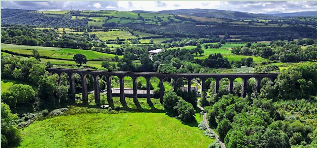
See the views for yourself. The map includes 16 heritage viewpoints — among them Dinefwr Castle, Newton House, Grongar Hill, Dryslwyn, Paxton’s Tower, Llandovery’s Roman fort, Cynghordy Viaduct, the Sugar Loaf, Builth Castle and the Royal Welsh Showground. For each one you can see how many pylons would stand within 3 and 5 km, then press See this view in 3D to stand at the site and look towards the line. From the Royal Welsh Showground alone, 35 pylons would stand within 3 km.
It can be done. Green Gen already plan to put 6 km of this line underground. We are asking for the same along the rest of the Towy and Usk valleys — no pylons, no wires and no scar on the skyline.
Underground cable leaves the landscape as it is. That is all we are asking for.
We have rebuilt our maps and tools around Green Gen's own pylon positions for the Towy-Usk route. Every pylon is now in its published location and carries Green Gen's own number — T001 to T355 on the main route, plus T106B to T141B on the alternative Option B, which Green Gen have not yet ruled out.
Find a pylon in 3D. In the 3D Pylon Visualiser you can now type a pylon number — for example T251 — and fly straight to it, circle round it to see it against the landscape, and step to the next or previous pylon along the line. Route flythroughs now have Slow, Normal and Fast speeds and Drone, Low and Side-on views.
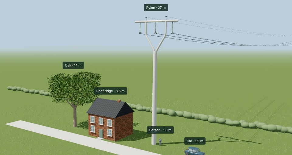
How tall will they really be? Green Gen state a standard height of 22 metres. But for their earlier steel lattice design they stated 27 metres — and their own route data showed towers averaging closer to 30 metres, raised wherever long spans, dips in the ground or crossings demanded it. Those spans have not gone away. Our T-Pylon Viewer now has a height slider from 22 to 30 metres, so you can see the difference beside a house, a tree and a person.
Updated figures. The Construction Impact Map now shows a 50m × 50m construction pad at every pylon, and its figures have been recalculated for the main route: 163 km of access roads and 220 hectares of land take. The Property Impact Calculator now uses the exact pylon positions on both route options.
Green Gen's own previous design had to be raised well above its stated height. We see no reason the new design will be any different.
We have built an interactive map that reveals the full scale of construction infrastructure required for the Towy-Usk pylon route — and the numbers are staggering.
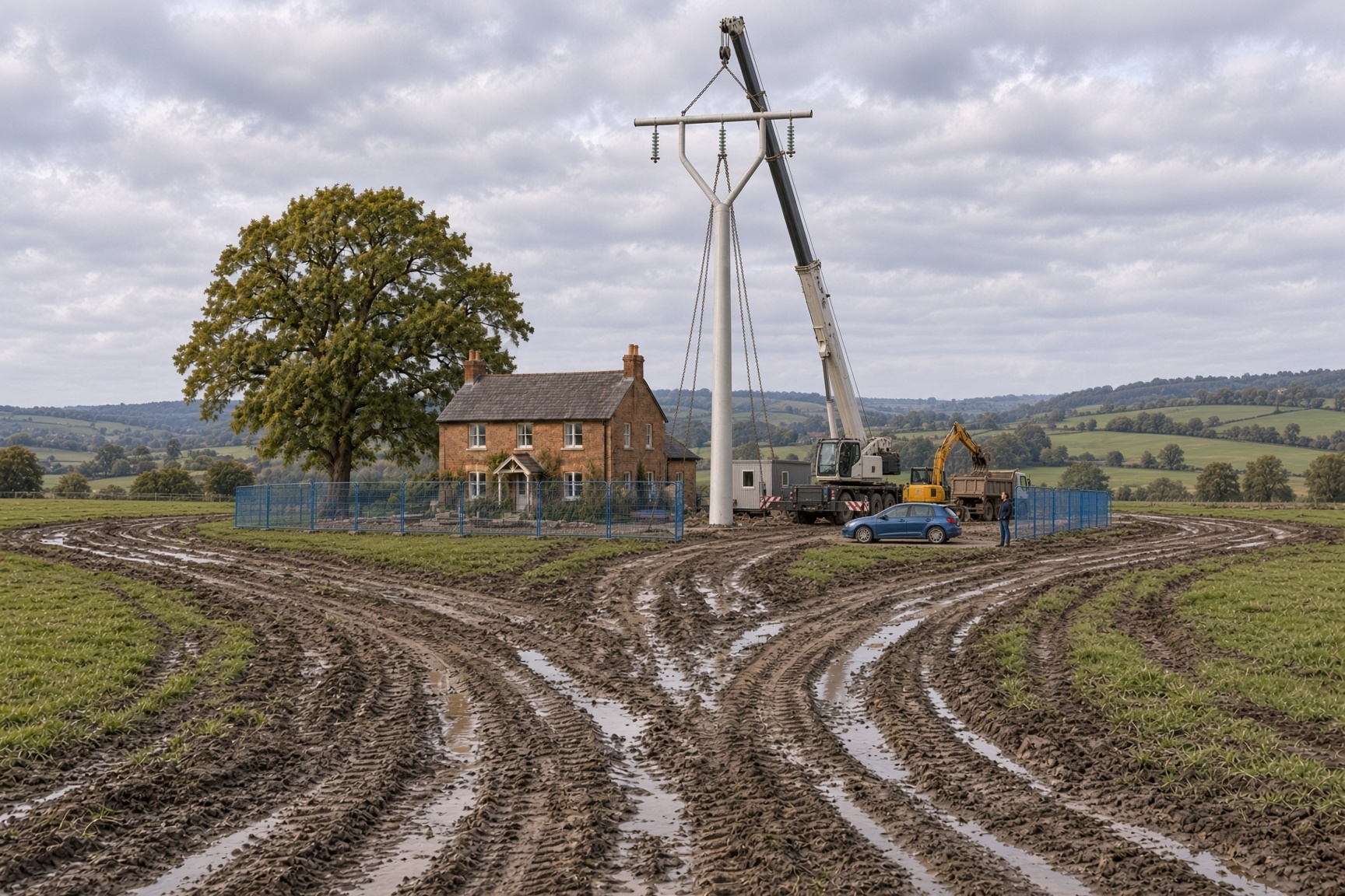
Updated 13 October 2026: figures below are now calculated for the Option A route (Green Gen's main 355-pylon route), with overlapping areas counted once. Our original figures included both route options and overstated some areas.
The map shows every access road, construction compound, scaffolding zone, drum yard, construction pad and pylon location along the 98 km route. All data is drawn from publicly available project information.
Key findings:
163 km of access roads — longer than the overhead line itself (92 km). Most must be built from scratch across agricultural fields that are wet for much of the year. That is 101 miles of new track.
355 T-pylons on the main route (with a further 36 on the alternative Option B) plus 94 wood poles — each T-pylon needing a 50m × 50m construction pad. 13 construction compounds and 164 scaffolding sites spread across the route.
The total land take is 220 hectares (545 acres) — equivalent to 309 football pitches, or 0.85 square miles of countryside.
The access roads alone cover 95 hectares — 133 football pitches of farmland carved up for construction vehicles — and the construction pads a further 89 hectares.
The construction access roads are longer than the pylon route itself. This is not a minimal-impact project — it is industrial-scale construction through some of the most beautiful countryside in Wales.
Explore the map yourself: Construction Impact Map
Green Gen Cymru has announced a change in pylon design for the Towy-Usk route — replacing the original steel lattice towers with a new "T-pylon" monopole design.
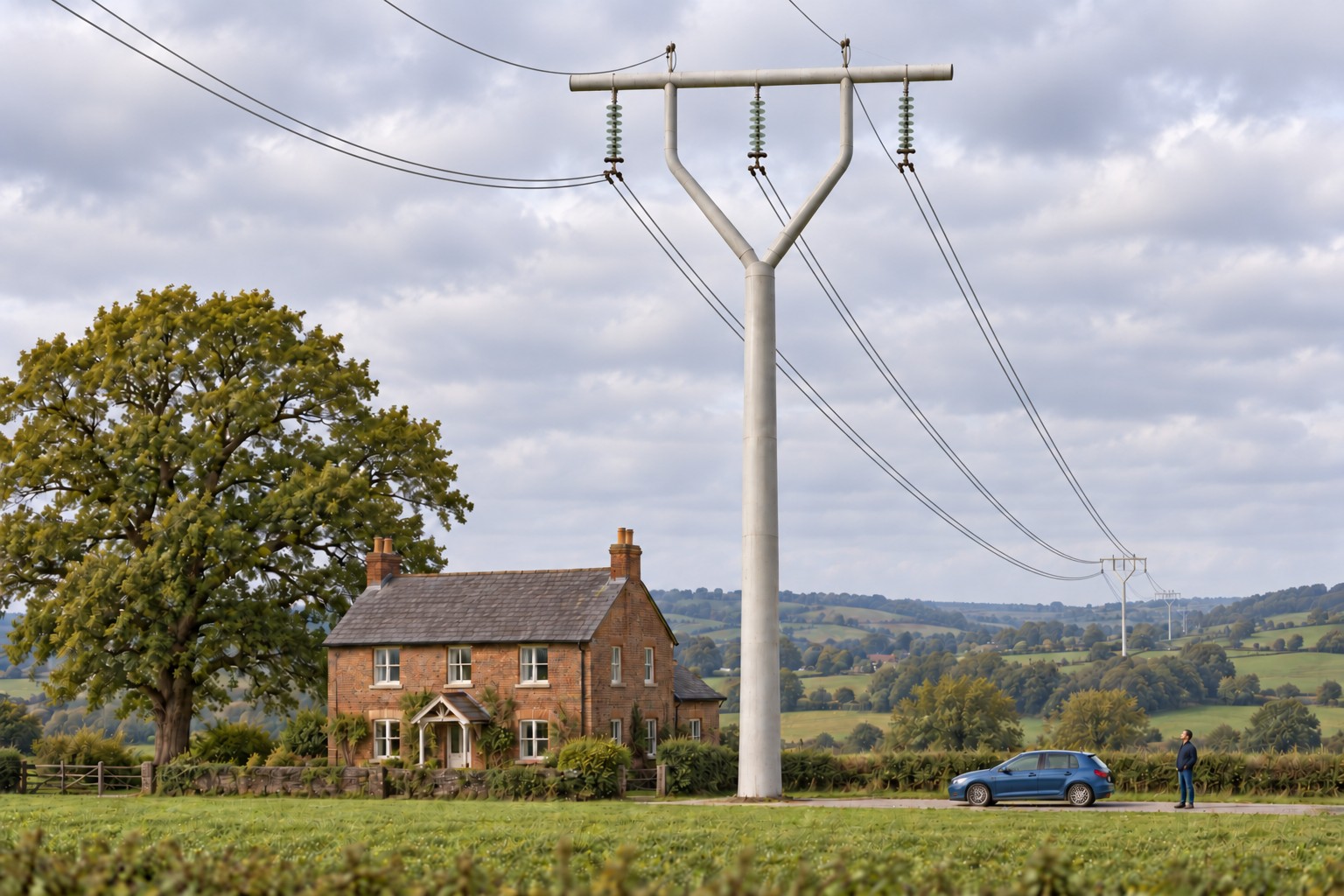
These are not the "low wooden poles" that communities were led to expect — they are industrial structures towering above a two-storey house.
We have created an interactive 3D viewer where you can explore the proposed T-pylon design in detail, rotating and zooming to see it from any angle alongside a house, car, and person for scale. Explore the T-Pylon Viewer
Our 3D Pylon Route Visualiser has also been updated — the Towy-Usk route now displays the new monopole design with accurate cable positions, replacing the lattice towers. View the updated route
Welcome to the new No Pylons campaign website. This site has been created to provide the communities of the Towy Valley with the information and tools they need to fight the proposed 359 steel pylons.
Explore our 3D Pylon Visualiser to see every proposed pylon plotted on the map, or use the Property Depreciation Calculator to understand how the pylons could affect your property value.
We will be posting regular updates here as the campaign progresses. To get involved, visit our Take Action page.